


The devastating floods that swept through San Antonio and the Texas Hill Country in 2025 left researchers with an urgent question: What can be learned from these events to better prepare communities for the next catastrophic flood?
So, when Civil & Environmental Engineering Ph.D. candidate Ayantika Rinti Bose set out to write her dissertation on hydrometeorological extremes in Texas, she knew it would be important to include the case studies about the June 2025 flood of San Antonio’s Beitel Creek and the infamous Kerr County flood that followed just weeks later. Bose emphasized that she and her fellow researchers wanted to do more than simply document the destruction. Their work was about learning and improving the response for future major flood events across the state.
“Every major event provides information that can improve flood science, forecasting, preparedness and community resilience,” Bose said. “Our hope is that understanding what happened can help reduce future losses.”
Bose and other researchers from UT San Antonio have been busy parsing flood data to put together a scientific report that can support discussions among emergency managers, engineers, planners and community leaders as they collaborate to make informed decisions across Texas. Bose recreated the floods using modeling software developed by the U.S. Army Corps of Engineers. The team also had access to data from the United States Geological Survey (USGS), National Oceanic and Atmospheric Administration (NOAA) and the U.S. Drought Monitor.
“Access to these datasets was critical because they allowed us to accurately reconstruct the event and evaluate its magnitude,” Bose said. “The fact that this data is publicly available also helps ensure transparency and reproducibility in flood research.”
As they’ve watched recent tragic flooding events unfold at the Nepal-China border and the Grand Canyon, they hope the lessons learned from their research can help save more lives.

Rainfall, hydrology and new expectations
More than 135 people were killed during the flooding in Kerr County and farther down the Guadalupe River on July 4, 2025, so Bose understands why there’s such a broad public interest in exploring why things unfolded the way they did — including the hydrological impacts.
“The event was not only a devastating human tragedy but also one of the most significant hydrometeorological events documented in Texas,” Bose explained. “As I began reviewing the rainfall, stream flow and flood impacts, it became clear that this event offered important scientific lessons about flash-flood processes and flood risk in Texas.”
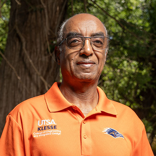
Bose’s adviser, and the report’s principal investigator, Hatim O. Sharif, PhD, from the Klesse College of Engineering and Integrated Design, has been studying flash floods since he came to UT San Antonio in 2005. Sharif, professor of Civil and Environmental Engineering and Construction Management, said there were multiple factors that likely contributed to the severity of last year’s July 4 flood.
One was that the South Fork of the Guadalupe River dramatically exceeded what’s called its “envelope curve.” In hydrology, that’s the maximum observed peak discharge of rivers measured against their drainage basin area. As much as 7,500 cubic meters of water came through the river in a matter of hours, according to Sharif, essentially reshaping the basin in a way the Hill Country had never seen.
Sharif said the event provides new data that planners, engineers and hydrologists should consider when evaluating assumptions about extreme rainfall and flooding in the region — especially as atmospheric water vapor levels have reached record levels across the globe.
“With more water vapor in the atmosphere, it drives this extreme discharge to become physically possible more often,” Sharif explained.
Targeted warnings and technological advances
The study also lays out how existing technology across the state can be utilized to enhance how rapidly changing flood conditions are monitored — particularly in rural areas.
According to their research, the USGS operates stream gauges that report every five or 15 minutes depending on the location. At the moment, however, those reports don’t link rainfall thresholds to automated, targeted warnings that could alert people in the proximity of specific low-water crossings or neighborhoods that might be affected.
“The technology is available and most of the data is available,” Sharif said. “What remains is configuring it for the places that need it and maintaining the monitoring networks that feed it.”
In addition to monitoring, Bose and Sharif have been studying how alerts and warnings are communicated during flooding emergencies. Their research suggests that detailed, well-placed alerts make a greater difference than frequent but generic flash flood warnings.
“The most effective warnings are specific and action-oriented,” Sharif said. “Which areas will be affected? When will they be affected? What do people need to do? Do they need to stay in shelter? Do they need to go to higher ground? Do they need to avoid specific roads?”
Education, collaboration and preparedness
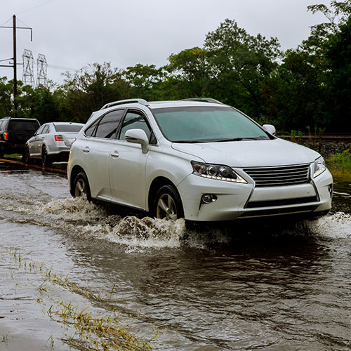
The solutions to preventing loss of life and property damage lie not just in advancements to flood forecasting and warning systems, Sharif explains. Effectively educating the public on how to protect themselves is also critical. It’s especially important for drivers on the road.
Almost 60% of flood deaths in Texas over the past six decades involved vehicles, according to Sharif’s research. In fact, Texas leads the nation in both flash flood fatalities and vehicle-related flood fatalities. He reflects on those stats often, especially when he recalls the 15 people who drowned in the rising flood waters at San Antonio’s Beitel Creek in the early morning hours of June 12, 2025.
“Eleven of them died in just a stretch of 1.5 miles because they drove into the service road and the service road was flooded. They got washed away,” Sharif said.
Sharif was pleased to see that many communities have placed a higher priority on flood preparedness this summer. When flash floods swept through San Antonio and parts of the Hill Country in July 2026, he acknowledged that many businesses and organizations urged people to stay off the roads, that sirens were deployed in some locations and that emergency messaging was generally clearer and more detailed.
“I think people were more focused and our communities were more aware of the potential impacts after the disasters we experienced last year,” Sharif said.
The continuous effort to educate and communicate about flash flood risks will require cross-collaboration across disciplines. Sharif vocally advocates for researchers in computer science, atmospheric science and hydrometeorology to join with traffic engineers, emergency responders and community leaders to enhance flood safety measures.
“We need to work with officials and first responders, so that they’ll have a better idea of what’s expected from them and what they need to do to prevent losses,” Sharif said.


